11 Historic & Scenic Harpers Ferry Hiking Trails
The Lifestyle Travelers contains affiliate links. If you make a purchase using one of these links, we may receive compensation at no extra cost to you. Read our disclaimer for more information.
LOOKING FOR THE BEST HARPERS FERRY HIKING TRAILS?
The historical small town of Harpers Ferry has plenty to offer – civil war attractions, 19th-century museums, hole-in-the-wall restaurants, and the most amazing hiking trails! Dylan and I enjoyed exploring the trails in this dainty town on a day trip from DC!
Bordering Virginia and Maryland, Harpers Ferry is located in West Virginia where the Potomac and Shenandoah rivers meet. The hiking trails surrounding Harpers Ferry have got it all. From rocky heights, rich forests, and deep ravines, you’ll have plenty of views to choose from on your visit.
Quick Summary
Top Hiking Trail for History Lovers: Bolivar Heights, Murphy’s Chamber
Best Hiking Trail for Beginners: Virginius Island & Hall Island Trails
Beautiful Hiking Trail Near the River: C&O Canal Towpath
Our Favorite Trail for a City View: Maryland Heights
Best Trail For a Challenge: Loudoun Heights

11 Best Harpers Ferry Hiking Trails: Overview
After you spend your morning learning about the town’s fascinating history, head to one of these hiking trails to take in the scenery at Harpers Ferry!
Are You Prepared For Your Trip?
11 Best Harpers Ferry Hiking Trails
Harpers Ferry is a prime location for hiking the Blue Ridge mountains. Depending on where you hike, you could visit three states in one day! All hiking trails in Harpers Ferry are open from sunrise to sunset.
Easy Hiking Trails in Harpers Ferry
To start things off, let’s go over the best hiking trails in Harpers Ferry for beginners! While many of these hikes can be completed by beginners, these ones are less challenging and are perfect for an afternoon stroll. Let’s dive in…

Bolivar Heights
Bolivar Heights is one of the best Harpers Ferry hiking trails if you’re interested in Civil War history. In this area, you’ll walk among civil war terrain and see Cannon and earthworks. You’ll also learn about civil war strategies as you pass through the wayside exhibits along the trail.
Aside from the history, this trail offers fantastic views of the Blue Ridge mountains, the Potomac River, and the Shenandoah Valley. This is by far the shortest and easiest hiking trail in Harpers Ferry, but you can always choose to extend your hike if you’d like.

Bolivar Heights Hiking Trails:
- Bolivar Heights Overlook: Crest loop trailhead, 0.3 mile loop trail, 6.6 feet of elevation gain, takes an average of 6 minutes to complete.
- Upper Loop: Crest Loop → Earthworks Trail → Upper Loop trailhead, 1.3 mile loop trail, 204 feet of elevation gain, takes an average of 55 minutes to complete.
- Upper & Lower Loop: Crest Loop → Earthworks Trail → Upper Loop → Skirmish Line Loop trailhead, 2.4 mile loop trail, 296 feet of elevation gain, average time of 1.5 hours to complete.

Virginius Island and Hall Island Trails
If you’re looking for an easy Harpers Ferry hiking trail that includes both history and great nature views, Virignius and Hall’s Island Trail is the one for you!
On this trail, you’ll travel through the riparian forest along the Shenandoah River and experience the blooming wildflowers, and natural wildlife. You’ll weave through various exhibits and see mill, turbine, and waterwork ruins, experiencing the history of the area. You’ll also have the opportunity to check out John Hall Rifle’s Work along the way.
Trail Notes: Virginius Island & Hall Island Trail trailhead, 1-mile loop trail, 23 feet elevation gain, average time of 18 minutes to complete.
>> Next UP: 10 Best Scenic Drives in West Virginia to Take in the Fall <<

C&O Canal Towpath
If you’re looking for a casual walk in Harpers Ferry, consider taking the C&O Canal Towpath along the Potomac River. This hiking trail is perfect for an afternoon stroll, a laid-back bike ride, or a place to cast your fishing pole. On your way to the trail, you’ll cross the bridge from Harpers Ferry and stand over the infamous “point” where the Potomac and Shenandoah rivers meet.
Once you cross over to the other side of the footbridge, you’ll have the option to take the towpath to the east – towards Brunswick, or west – towards Shepherdstown. This is a great trail if you have no destination in mind, and just want to enjoy the simple joys of the outdoors.
Trail notes: Chesapeake & Ohio Canal Towpath, 17.9 miles out and back, 54 feet elevation gain, you can take this path for as long or as short as you’d like.

Murphys Chamber
Murphys Chamber is the perfect Harpers Ferry hiking trail to complete after stopping at the Visitor Center. This hiking trail highlights the beauty of the Shenandoah River and the surrounding mountain range.
Check out the Civil War cannon and earthwork sites, as well as one of the previous locations of John Brown Fort doing the full loop. If you’d like to keep the route short, take a turn at the Murphy’s Chamber house to complete the loop.
Murphys Chamber Hiking Trails:
- Shorter Route: Murphys Chamber Farm Trail trailhead, 1-mile loop, 187 feet of elevation gain, average time of 30 minutes to complete.
- Longer Route (with additional Historical Sites): Murphys Chamber Farm Trail trailhead, 2.9 mile loop trail, 259 feet elevation gain, takes an average of 1 hour and six minutes to complete.
Harpers Ferry Moderate Hiking Trails
Let’s get into some of the amazing hiking trails in Harpers Ferry that require a bit more of a challenge! While still enjoying historical sites, you might work up a sweat on some of these trails!

Schoolhouse Ridge North Trail
Schoolhouse Ridge is a hiking trail in Harpers Ferry with a wide-open view. Walk through rolling farm hills as you see the terrain from Bolivar Heights, Maryland Heights, the Confederate perspective of 1862, and cannons from the Civil War.
Overall, this is one of the best trails to observe the Civil War terrain because of the cannons that fan across the area. Unlike other hiking trails in Harpers Ferry, this route offers little to no shade, so consider bringing a hat, adequate water, and sunscreen if you’re visiting during the summer months.
Trail Notes: Moler Farm Trail trailhead, 1.75-mile loop trail, elevation gain of 110 feet, the average time to complete is 36 minutes.

Visitor Center from Lower Town
This hiking trail is a great route to take from the Visitor Center parking lot to the town of Harpers Ferry. There are free shuttle buses available, however, this trail is a great alternative for those who have pets or just want extra exercise.
This trail begins near the center of the tree line just south of the visitor center building, behind the main parking lot. This is a great trail to see Harpers Ferry wildlife including, geese, turtles, herons, wood ducks, and if you’re lucky, muskrats or beavers.
The only reason this hike is considered moderate is that the trail begins by descending 97 stone steps. As you pass through the wetlands, you’ll also encounter waterfalls, a pulp mill, and remnants of the Shenandoah Canal along the way into town.
Trail Notes: Shenandoah Trail trailhead, 1.7 miles one way, 50 feet elevation gain, average time to complete is 45 minutes.

Camp Hill
This hiking trail, also known as Harper’s Ferry Appalachian Trail Loop provides a fantastic saunter through various landmarks. The route has mountain and river views, but you also have an opportunity to see Jefferson Rock, Harper Cemetery, Storer College Campus, and the Appalachian Trail Conservancy Center.
Begin your hike at the Information Center in Lower Town and begin your ascent up 62 historic stone steps to Jefferson Rock. From there, you have a few options on how to complete the loop. You can make your hike longer by continuing up the Appalachian Trail.
Trail Notes: Appalachian Trail → Cliff Trail → Viriginius Island Trail trailheads, 1.8-mile loop trail, 213 feet elevation gain, average time of 44 minutes to complete.

Schoolhouse Ridge South
Harpers Ferry School House Ridge South hiking trail offers all-inclusive views of the area of the region as you make your way along the ridge line.
See sweeping views of Maryland Heights, Loudoun Heights, and Bolivar Heights during your trip. This route offers countless different views of Flowing Springs Run, farmland, forest and glade sights, various ruins, and Civil War cannons.
There are two options for exploring the School House Ridge South area of Harpers Ferry: Courtney’s Battery Trail and Allstadt Farm Trail. Choose which route to take based on which sites you’d like to see, or, combine the two loops to create a 3.7-mile-long loop.
Schoolhouse Ridge South Hiking Trails:
- Courtney’s Battery Trail: 1.2-mile loop, 75 feet elevation gain, average time of 30 to 40 minutes to complete. More emphasis on history.
- Allstadt Farm Trail: 2.5-mile loop trail, 230 feet of elevation gain, average time of 1.5 miles to complete. More emphasis on nature and history.
>> Exploring more of West Virginia? Check out Blackwater Falls State Park Cabin Rentals! <<

Overlook Cliff Trail
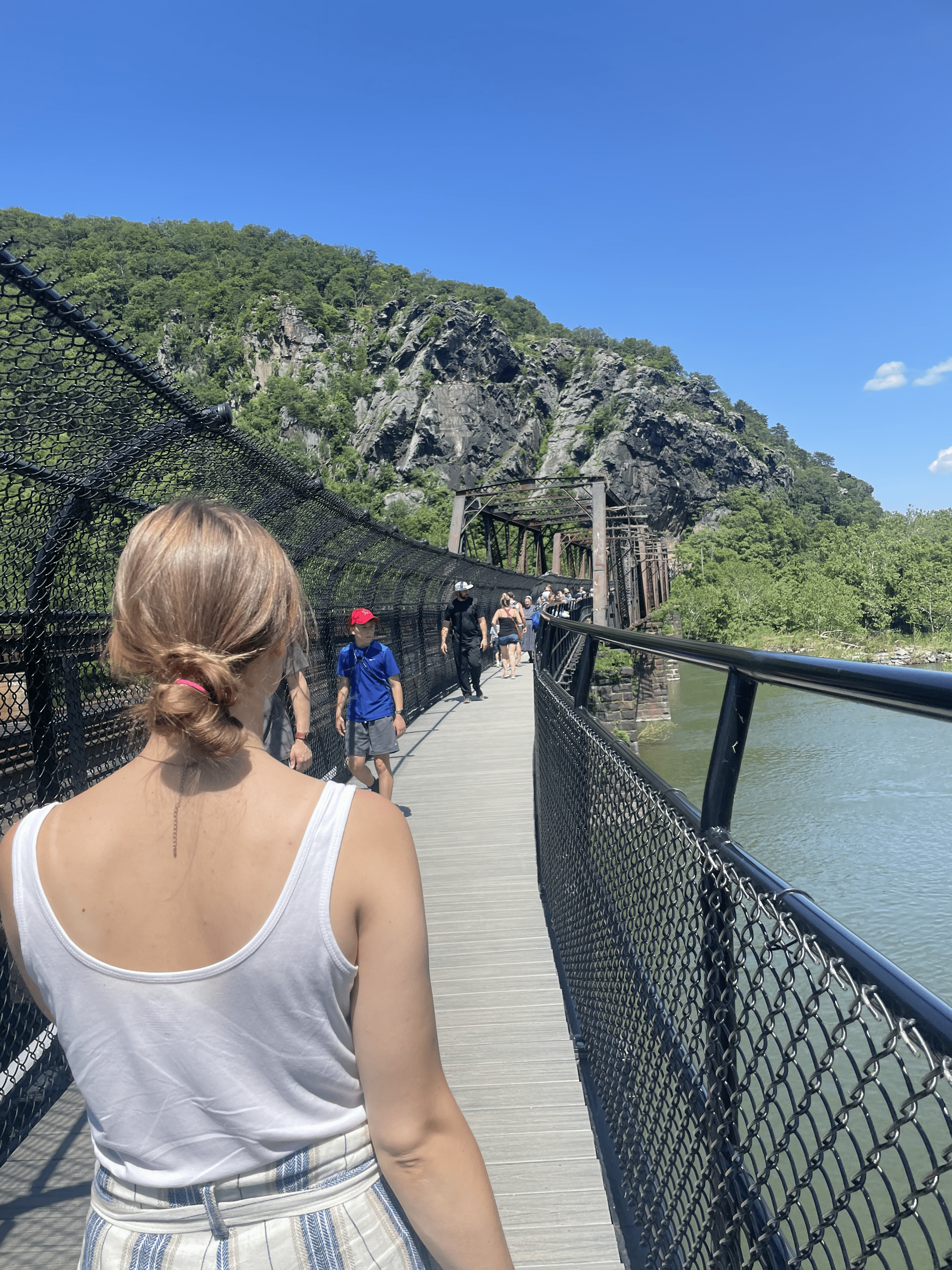
Explore Maryland Heights by taking one of the most famous hiking trails in Harpers Ferry: the Overlook Cliff Trail. This is a great trail to see the all-encompassing Harpers Ferry through the area’s natural landscape and important aspects of its history. This is the hike we did in Harpers Ferry and couldn’t recommend it enough!
Beginning from the Information Center in Lower Town, you’ll make your way to the footbridge that crosses the river. Once you’re across the bridge, you’ll take a left onto the C&O towpath for .3 miles. You’ll then need to cross over a wooden bridge and across the road to reach the Maryland Heights trailhead with the green blaze.
Continue on this trail and take a slight right to see the historic naval battery. Continue walking uphill and take the red blaze trail to Overlook Cliff. It’s all uphill, so make sure you’ve got enough water and good shoes for this one!
Trail Notes: Overlook Cliff Trail trailhead, 4.5 miles out and back, 1,154 feet elevation gain, average time of 3 hours and 24 minutes to complete.
Challenging Hiking Trails in Harpers Ferry
Now that we’ve covered the easy and moderate hiking trails in Harpers Ferry, let’s look at the challenging hikes in the area! If you’re going to attempt these, make sure you have plenty of water and good hiking boots!

Loudoun Heights
One of Harpers Ferry’s more challenging hiking trails, Loudoun Heights provides the only view into the city of Pleasant Valley. This rewarding hike brings you to the Split Rock overlook where you can see the confluence of the Shenandoah and Potomac rivers from above.
Experience part of the Appalachian trail on this route as you wind through formations of quartzite and phyllite rock. This route is great for more experienced hikers who want to see multiple views of the rivers, Harpers Ferry, neighboring cities, and beyond.
There is the River Access Parking Lot just below the highway bridge, however, it is intended for visitors using the river access and fills quickly.
Trail Notes: Appalachian Trail → Blue Trail trailhead, 7.5 miles out and back, 1,377 feet elevation gain, average time of 4 to 5 and a half hours to complete.

Stone Fort Trail
This hiking trail is another great way to experience Harpers Ferry and serves as an add-on to the Overlook Cliff Trail. This route offers additional sites such as 30 and 100-pound batteries, Stone Fort, and breastworks, and is a great way to experience Harpers Ferry while getting in a workout.
This route is a nice 2.2-mile extension from the overlook cliff. You’ll receive all of the same breathtaking views and experience more Civil War history. Take in the shade as you walk uphill through the bountiful forest and through the rocky cliffs.
Access to the trail begins from the Information Center. You’ll cross the footbridge, take a left onto the C&O towpath, and cross the wooden bridge and road until you reach the Maryland Heights trailhead.
Trail Notes: Maryland Heights → Overlook Cliff Trail → Stone Fort Trail trailheads, 6.3-mile loop trail, 1,522 feet elevation gain, average time of 4 hours and 36 minutes to complete.
Best Harpers Ferry Sunrise Hikes
Now that I’ve covered the best 11 hiking trails in Harpers Ferry, let’s go over some of the best spots to watch the sunrise. Keep in mind that the parking lots in Harpers Ferry don’t open until sunrise, so you’ll need to find parking in town or in a paid lot to complete these hikes.

>> MORE POSTS on West Virginia: Best Places to Stay Near New River Gorge <<

Parking At Harpers Ferry
Besides choosing which hiking trail to complete, it’s critical to know where to park once you arrive. There are plenty of parking options in Harpers Ferry, however, it’s important to know about them beforehand because they can fill up quickly. All lots are open from sunrise to sunset.
Parking Lots
The most accessible parking lot is at the Visitors Center. Once you park, you can take the free shuttle down to Lower Town to explore Harpers Ferry. There are 1,000 total spaces with 35 oversized spaces and it is wheelchair accessible.
Additionally, there is the River Access parking lot located at the junction of Shenandoah Street and Highway 340. It’s designated for those using the river access, but with only 36 spaces, parking is extremely limited.
If you’d rather park in town, you can use the Train Station parking lot off Potomac Street. This parking lot typically fills up quickly and is limited to only 81 spaces. It is wheelchair accessible.

Trailhead Parking
In addition to parking lots, there is also trailhead parking offered in some locations. Here is a comprehensive list:

Cost To Enter Harpers Ferry
Visitors are required to purchase a pass to enter Harpers Ferry National Historical Park. This pass includes access to hiking trails, exhibits, facilities, programs, and parking lots. The pass is valid for three consecutive days. The entrance fees are as follows:
- $20 per vehicle
- $15 per motorcycle
- $10 per person if traveling by foot or bike
- $35 annual pass (purchase at the entrance station)
You must place your receipt on the dash where parking enforcement can see it. If you have the America The Beautiful or Interagency pass, leave the signature side up on the dash. You can purchase your pass online or at the entrance station at the Visitor Center.
The few days of the year that it’s free to enter Harpers Ferry are MLK day (January 16th), the first day of National Park Week, the anniversary of the Great American Outdoors Act (August 4th), National Public Lands Day (September 23rd), and Veterans Day (November 11th).

Conclusion: Harpers Ferry Hiking Guide
There you have it! 11 of the best hiking trails in Harpers Ferry. Whether you want to take a historic stroll or conquer part of the Appalachian Trail, you won’t be disappointed during your visit!
Plan your visit during the spring, fall, or on one of the free days to get the most out of your trip to this infamous historic town! You won’t regret it!
Happy trails!